PegelTiefgang
Loading...
Gauge Düsseldorf — current water level and draft
Rhine · km 744
Measurement—cm
Loading...
Gauge Düsseldorf is on the Rhine at kilometre 744, on the km 710–763 stretch. The GlW is 91 cm and the fairway depth maintained below it (TuGlW) is 250 cm; after deducting 30 cm of safety margin the official rule of thumb comes out at Düsseldorf +129. In practice Düsseldorf +130 is used here, +1 cm against the official rule. At high water Marke I is at 710 cm and Marke II — above which the waterway closes — at 880 cm. This gauge has 3 forecast sources: the 4-day forecast from Elwis (green), the 2-day forecast from the Hochwasserzentrale Rheinland-Pfalz (red) and the 14-day forecast from the BAfG (yellow). Upstream lies Köln, downstream Duisburg-Ruhrort.
Düsseldorf
The bottleneck at Düsseldorf is mainly the shoal in the middle/right side of the fairway in the bend upstream of the Rheinkniebrücke. Currently, work is being done to deepen the fairway from 250 cm below GlW [Equivalent Water Level] to 280 cm below GlW (same as the downstream sections Duisburg, Wesel etc.). For the time being, the outer bend is the shallowest in any case. It is best to sail on the left bank, keeping approx. 100m distance for the first two groynes upstream of the bridge (well within the official fairway), from the third groyne and further upstream at approx. 50m distance (from the third groyne outside the fairway). The bottom here is at approx. Düsseldorf gauge + 220 cm, while in the outer bend it is officially Düsseldorf + 159 cm 'deep', if not less, as has often been the case lately. See also Elwis Shallow Depths (unfortunately not very clear, but that's the best available in Germany).
See also the depth charts of the Dutch and German Rhine branches on pdf v20-08-2026, but note that these depth charts of Düsseldorf are outdated; the once quite deep 'channel' through the outer bend practically no longer exists, see figure: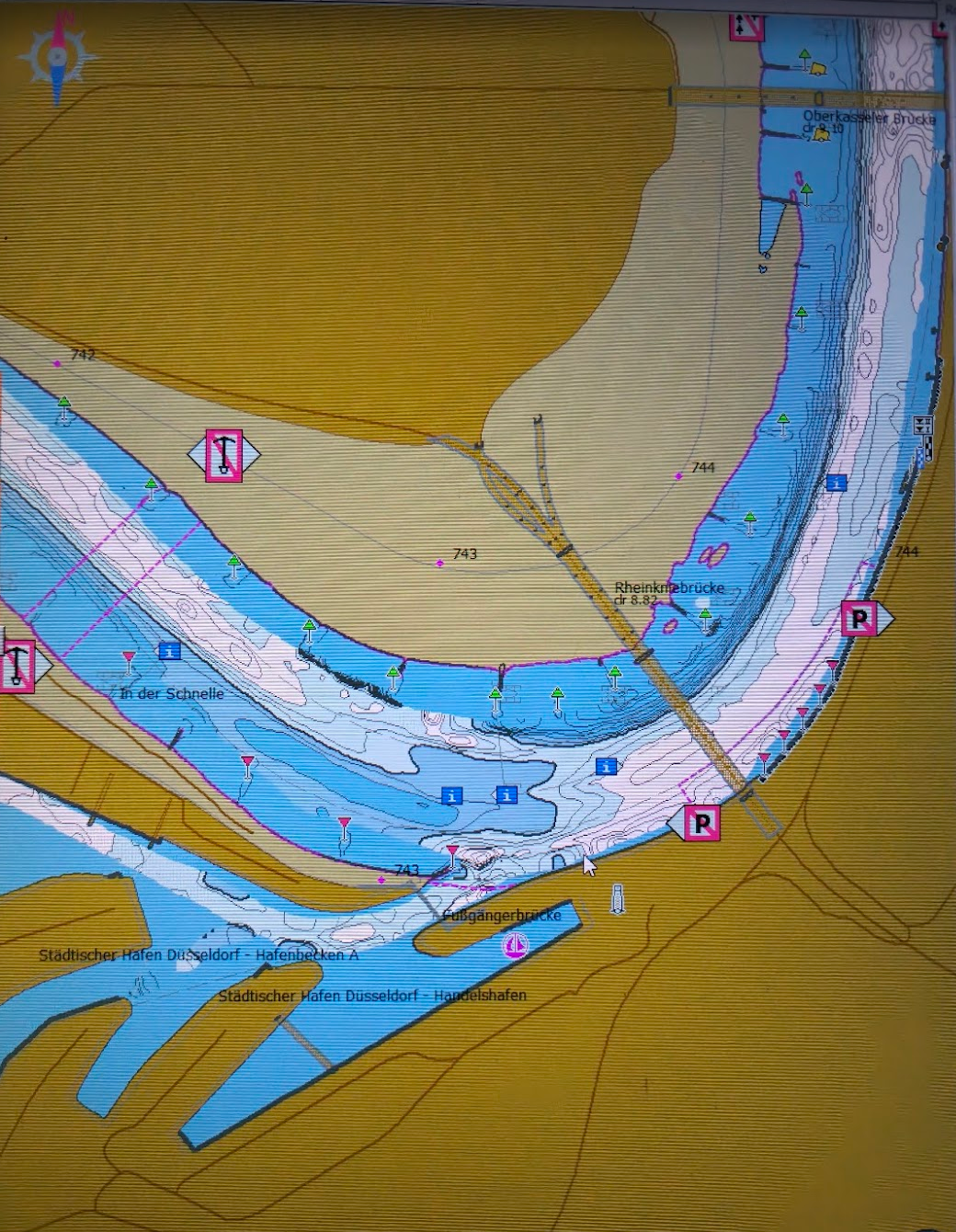
See also the depth charts of the Dutch and German Rhine branches on pdf v20-08-2026, but note that these depth charts of Düsseldorf are outdated; the once quite deep 'channel' through the outer bend practically no longer exists, see figure: